We’ve come across many photographs and stories during our research and travels exploring the geography and histories of What Makes the Humber. This is the first of the galleries of ‘What Made the Humber’.
Barton Tile Works
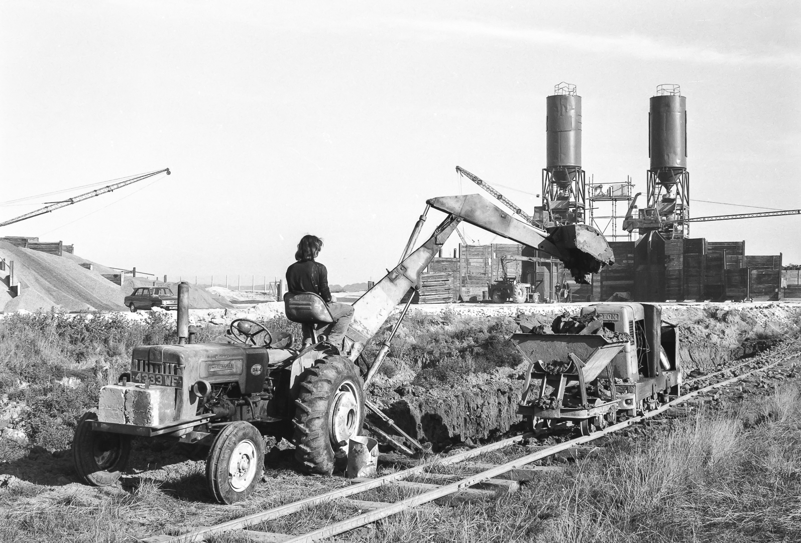
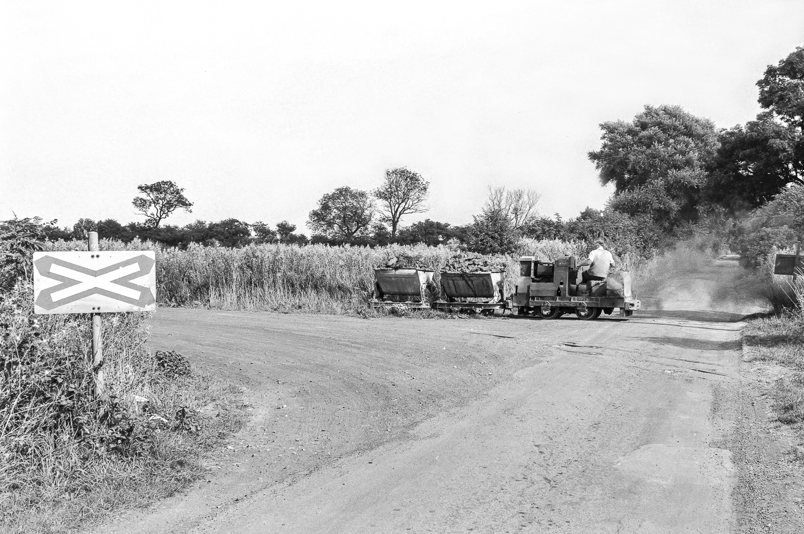
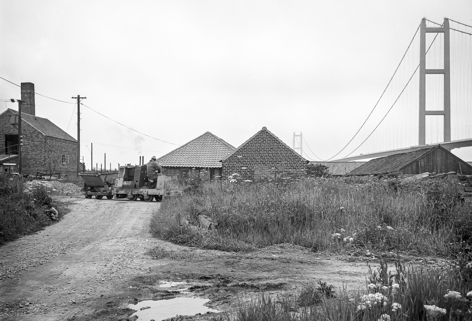
There are – and were – tile works east, under and west of the Humber Bridge between New Holland and Chowder Ness for centuries. The Far Ings nature reserve, west of Barton, was developed from the clay pits dug for 19th and 20th century tile production. The photographs in the gallery below were taken by Stuart Fountain of Nottingham between 1975 and 1985 showing the narrow gauge railway used for clay transportation to the kilns for tile production. The later photographs show the Humber Bridge in the background and during construction.
Many thanks to Dave Waldren of Cutting Edge Transport Images Collection for the photographs and permission to publish these evocative images here, especially for What Made the Humber.


Rich and Lou Duffy-Howard
If you’ve enjoyed reading this post, we’d be grateful if you’d subscribe to our blog. You can do so here:
And introducing, for 2024 – ‘Goole by Barge‘ exhibition of 60 photographs, music and videos at Goole Museum February 9th – April 13th 2024. Info here