2005 – 2021
All of the images and accompanying text are copyright Bernard Sharp and used with permission and under licence (creativecommons.org/licenses/by-sa/2.0). All of the photographs are numbered with the corresponding text by Bernard to accompany each photograph below the gallery.


- Humber Street, Kingston upon Hull Wednesday, 29 December, 2010. Central Dry Dock, 1820, extended circa 1875. This dock was built for Gleadow’s Shipyard and used for the construction of new wooden boats. It was later extended for the repair of larger iron ships. The dock has been disused for many years, the incoming tides depositing mud through the less than watertight lock gates. Viewed on a misty day. Grade II Listed Building..
- Graving Dock, Humber Street, Kingston upon Hull Monday, 11 June, 2012 Having removed the accumulation of mud from the derelict dry dock, work is underway to pump in water from the Humber estuary. In the background: the Tidal Surge Barrier on the river Hull.
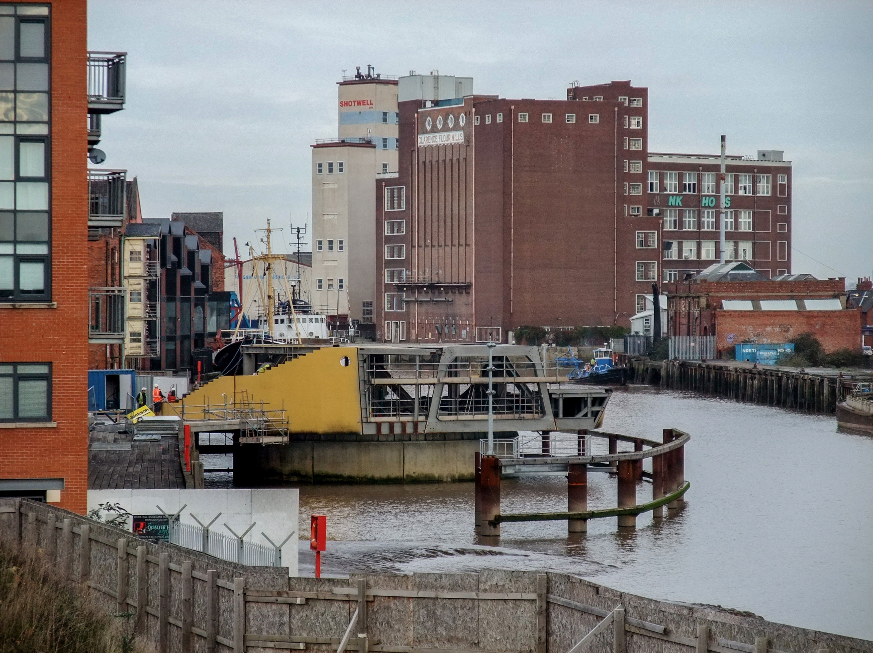
- Scale Lane Bridge, Kingston upon Hull Friday, 18 November, 2011. Begun in 2009, work progresses on the construction of a new footbridge across the river Hull from Scale Lane Staithe to Tower Street. Originally named the Boom Bridge, it was officially opened as the Scale Lane Bridge on 28 June 2013.
- River Hull, Kingston upon Hull Thursday, 22 April, 2021A tank barge enters the River Hull from the Humber Estuary. In the background, Victoria Pier and premises in Nelson Street and beyond.
- Old Harbour, River Hull, Kingston upon Hull, Friday, 19 April, 2013. A barge, in reverse, passes by Tradewinds apartments, Wincolmlee, and beneath North Bridge.
- Dock Office Row, Kingston upon Hull Wednesday, 27 June, 2012. Historically important for being the last major relic of Kingston upon Hull’s first enclosed dock (known in succession as The Dock, Old Dock & Queen’s Dock) and for retaining the last ‘Scotch’ type derrick in the Old Town – a distinctive port-related feature and a rare reminder of the city’s shipbuilding past. The 11 acre Queen’s Dock was opened in 1778 and closed in 1930. The main dock was filled in to create Queen’s Gardens and the dock basin was reused as a dry dock from 1957 up until the end of the 20th century.
- Lime Street, Kingston upon Hull Saturday, 6 April, 2013 Chambers & Fargus, seed crushers and edible oil refiners, was established in Wincolmlee in 1854. In 1907, the Anglo-Egytian Oil Mills & Refinery, Lime Street, next to the river Hull, depicted, were purchased from the late George Hodge. The milling operation closed down in 1991. Viewed from Wincolmlee.
- Old Harbour, River Hull, Kingston upon Hull Friday, 19 April, 2013 The Old Harbour, viewed from Garrison Side, with Clarence Flour Mills, centre background, and premises of John H Whitaker, Tower Street, right foreground. Public Right of Way No.11 within the city extends 1,100 metres from North Bridge to The Deep at Sammy’s Point. A section of the Way south of the former Victoria Dock entrance has been closed for a long time due to the crumbling boardwalk. The interruption to the footpath is in the form of a metal fence immediately south of the former Trinity House buoy shed. Information on the City Council’s ‘Rights of way improvement plan 2009 – 2019’.
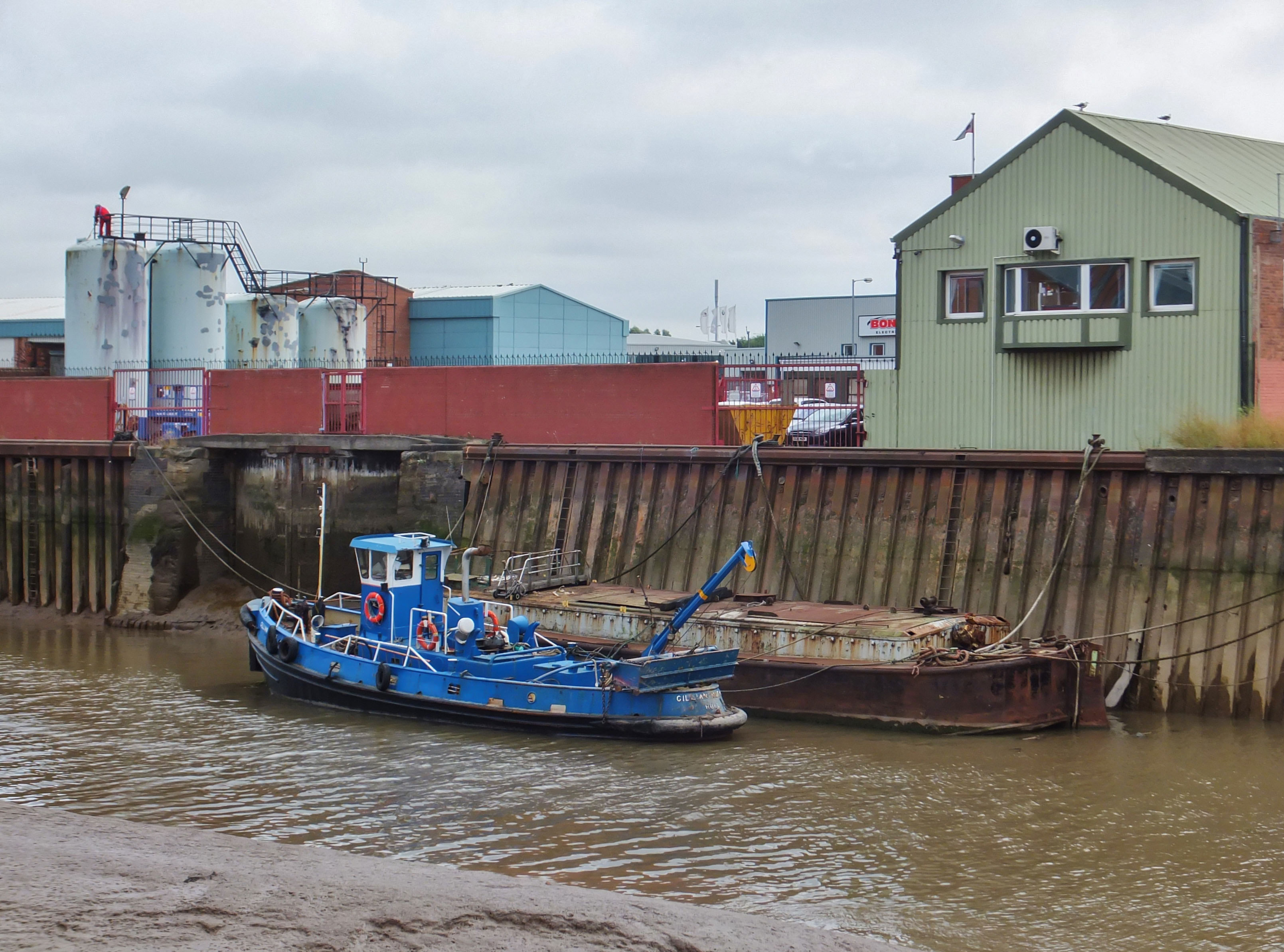
- Old Harbour, River Hull, Kingston upon Hull Friday, 2 August, 2013 The tug ‘Gillian Knight’ and a barge moored adjacent to the entrance to the former dry dock of John H. Whitaker (Holdings) Ltd. on the east bank of the River Hull.
- Old Harbour, River Hull, Kingston upon Hull, Tuesday, 27 August, 2013. The Shotwell tower, Clarence Street, and Clarence Flour Mills reflected in the still waters of the river Hull.
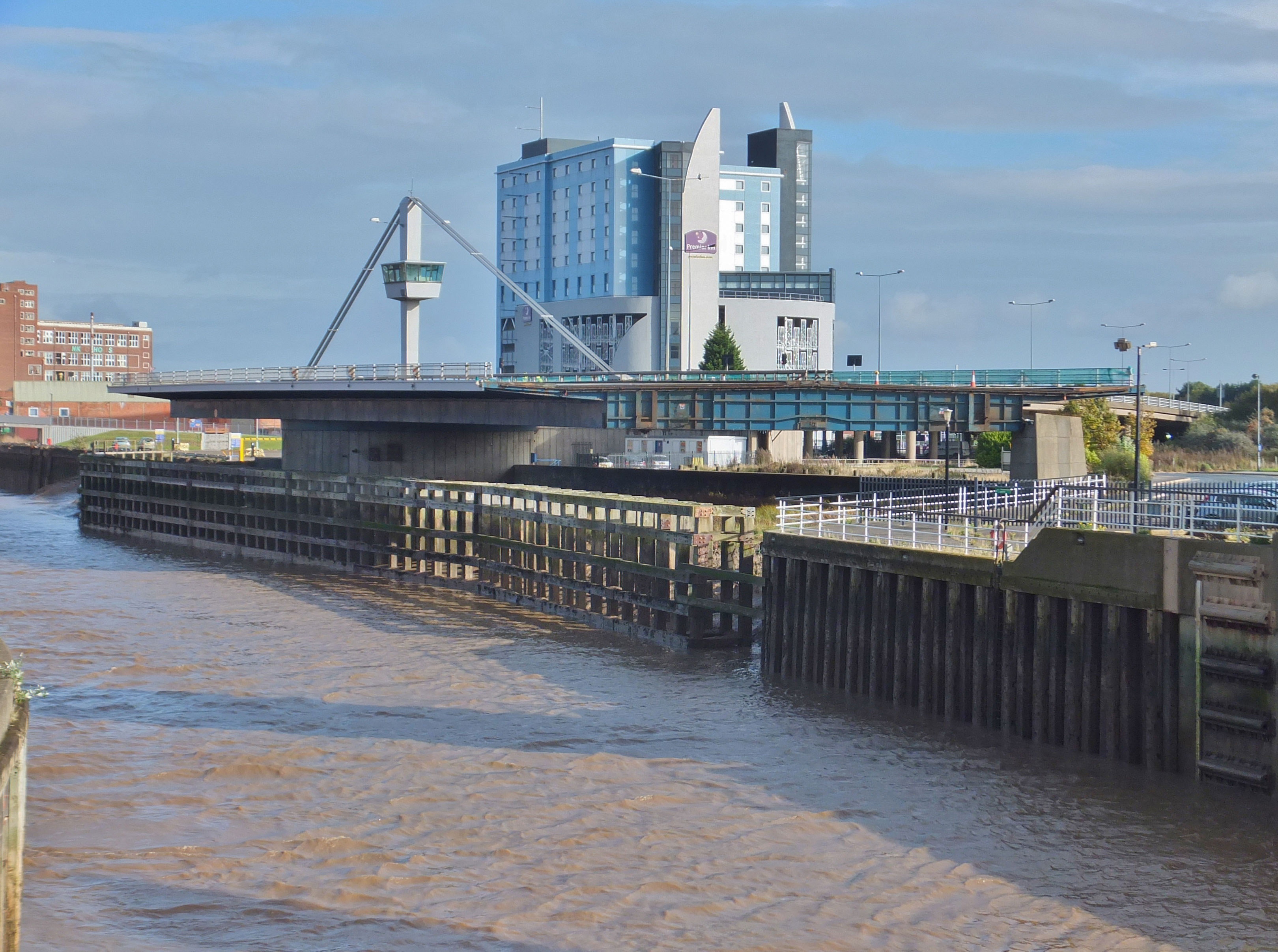
- Myton Bridge, Garrison Road, Kingston upon Hull Sunday, 20 October, 2013. The bridge over the river Hull is closed for maintenance. Centre background: the Premier Inn, Tower Street.
- Old Harbour, River Hull, Kingston upon Hull Thursday, 6 May, 2021. ‘Bartholomew’, British Waterways vessel 4000230, moored at the piers originally installed to secure the Arctic Corsair when it was a floating attraction alongside Hull Museums. No data on this vessel can be traced online.
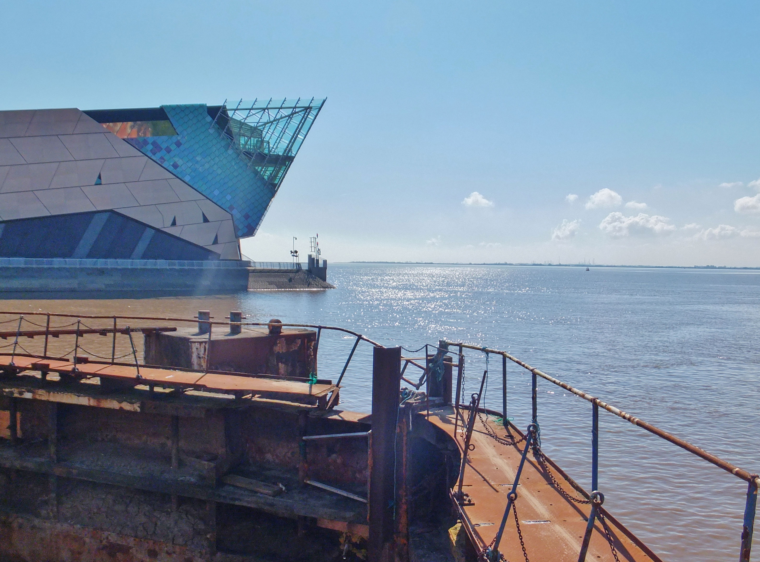
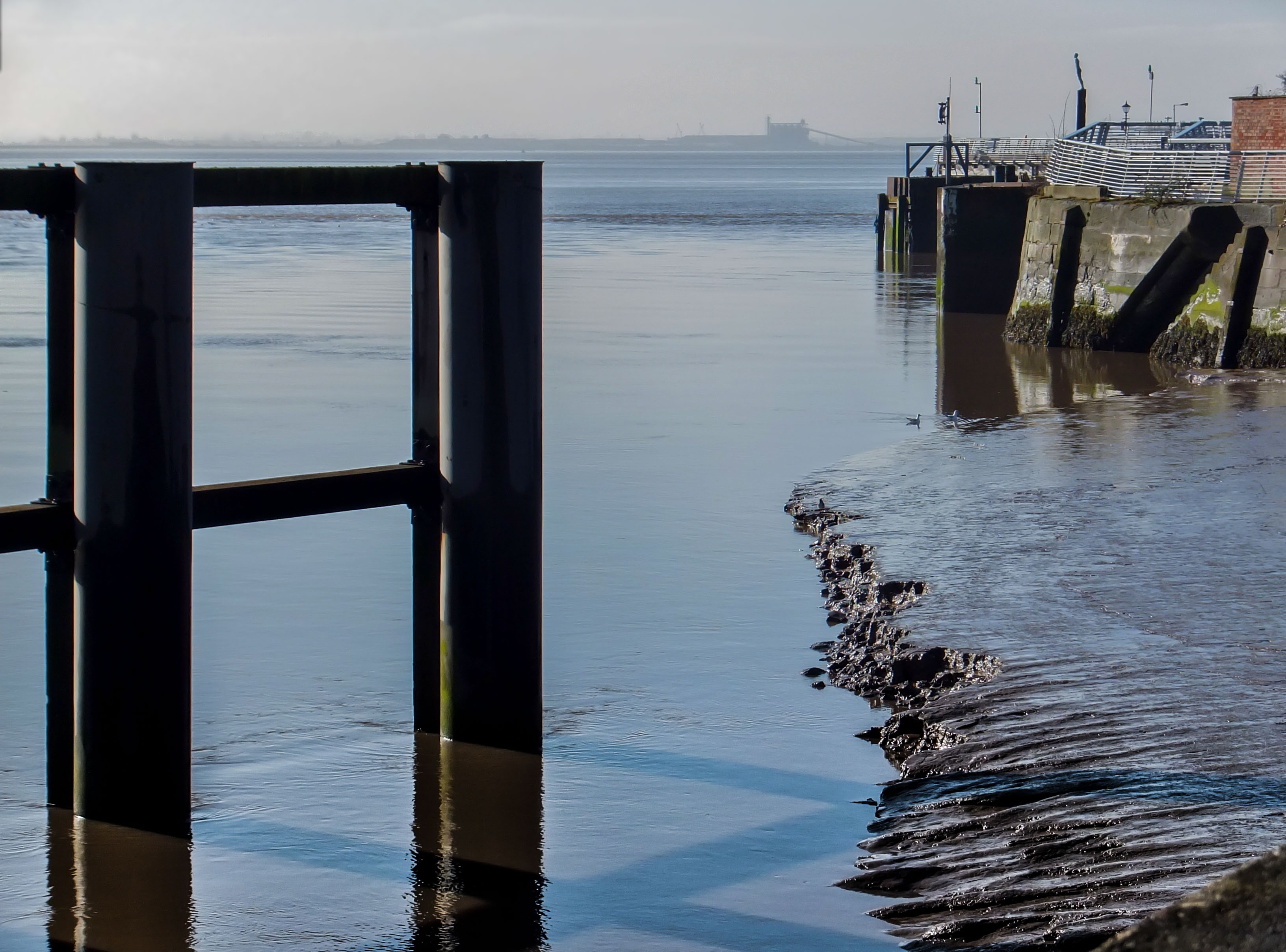
- Old Harbour, River Hull, Kingston upon Hull Tuesday, 27 August, 2013. The Deep and the lock-gates of the Humber Street dry dock at the confluence of the river Hull and the Humber estuary.
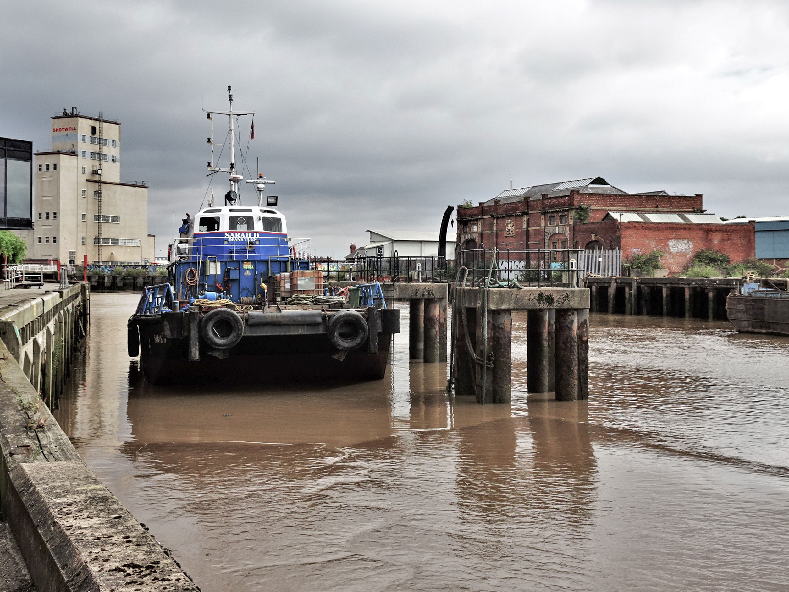
- Old Harbour, River Hull, Kingston upon Hull Tuesday, 10 August, 2021. Built in 1978 as a fire boat, the ‘Cleveland Endeavour’ was converted to a push tug circa 2001, when it was also renamed ‘Sarah D’. Operated by Deans Tugs, the vessel is moored alongside the piers originally installed for the berthing of the trawler ‘Arctic Corsair’, a visitor attraction.
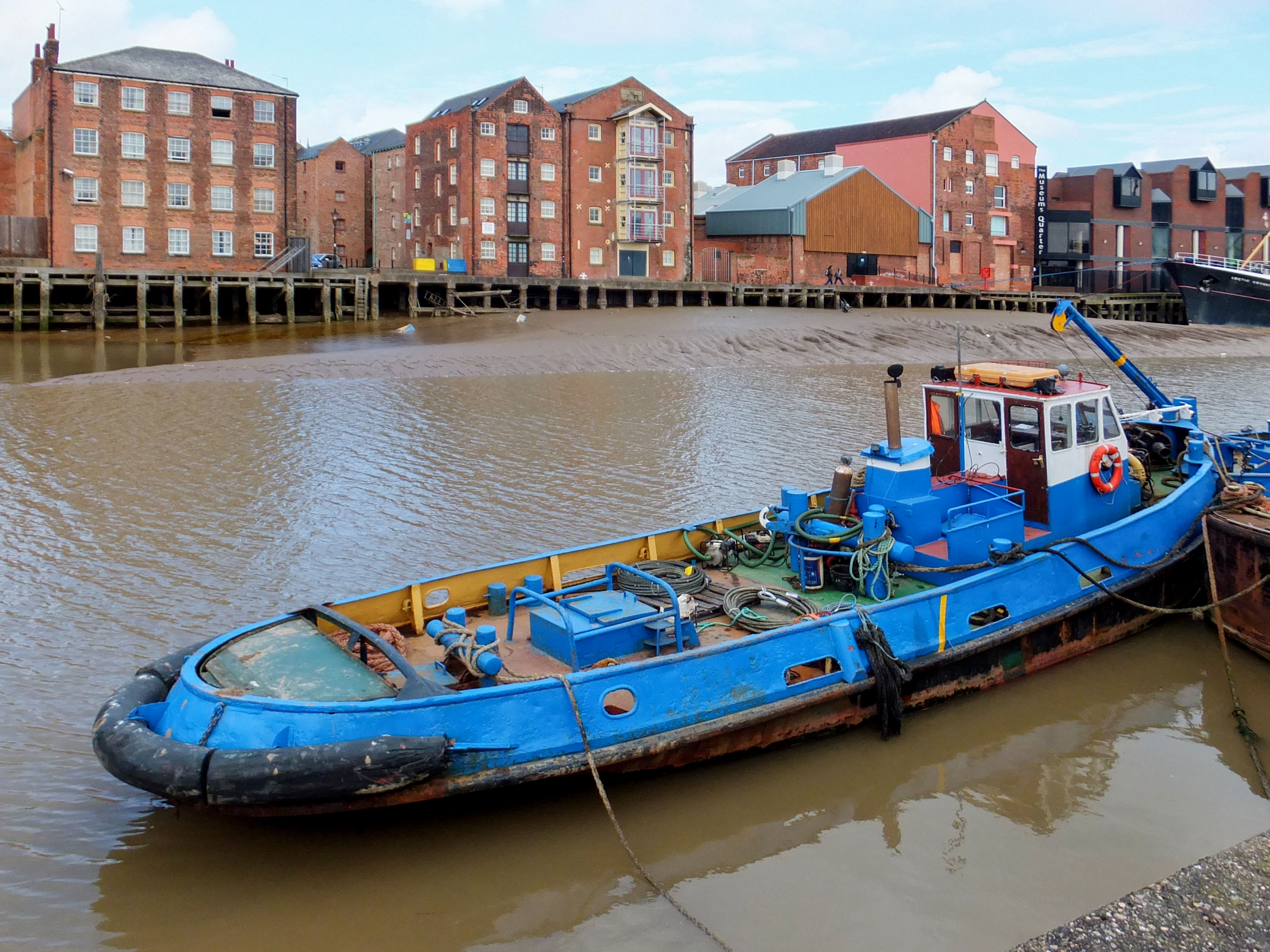
- Old Harbour, River Hull, Kingston upon Hull Friday, 19 April, 2013. Former warehouses, Nos.40 to 35 High Street, fronting the Old Harbour, River Hull, with tug boat moored at Garrison Side.
- Old Harbour, River Hull, Kingston upon Hull Tuesday, 27 August, 2013 The Shotwell tower, Clarence Street, and Clarence Flour Mills, viewed from the east bank of the river Hull adjacent to Lister Court, No.22 High Street.
- River Hull, Kingston upon Hull Friday, 5 April, 2013 The footbridge across the river Hull, immediately south of the Tidal Surge Barrier, links Humber Street on the west bank to South Bridge Road on the east, providing pedestrian access to Victoria Dock Village and The Deep.
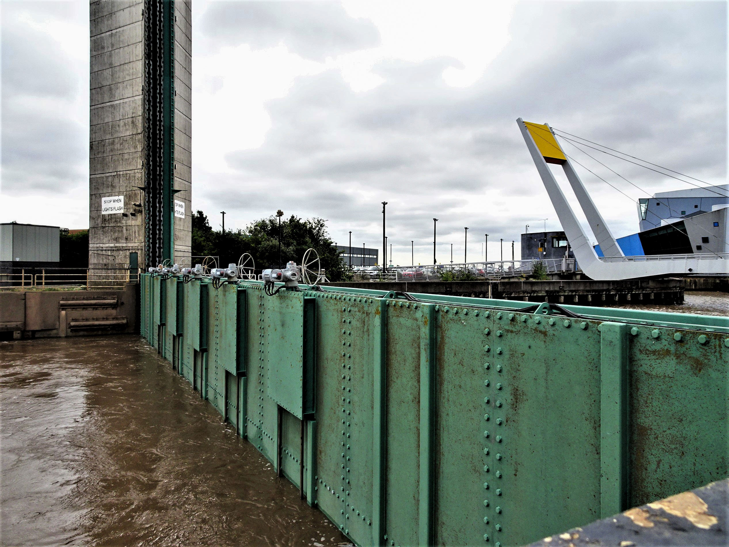
- Tidal Surge Barrier, River Hull, Kingston upon Hull Monday, 8 March, 2010. Kingston upon Hull has a very long history of the land adjacent to the River Hull being flooded due to tidal surges. To eliminate this ongoing problem, the Hull Tidal Surge Barrier was constructed at the mouth of the river. It was opened 15 April 1980. Grade II Listed Building. The barrier is depicted in its lowered position, coinciding with high tide at 09:39. The barrier takes about 24 minutes to lower, protecting about 17,000 properties. It will be operated about 30 times per annum, when high tides are expected to funnel water into the River Hull.
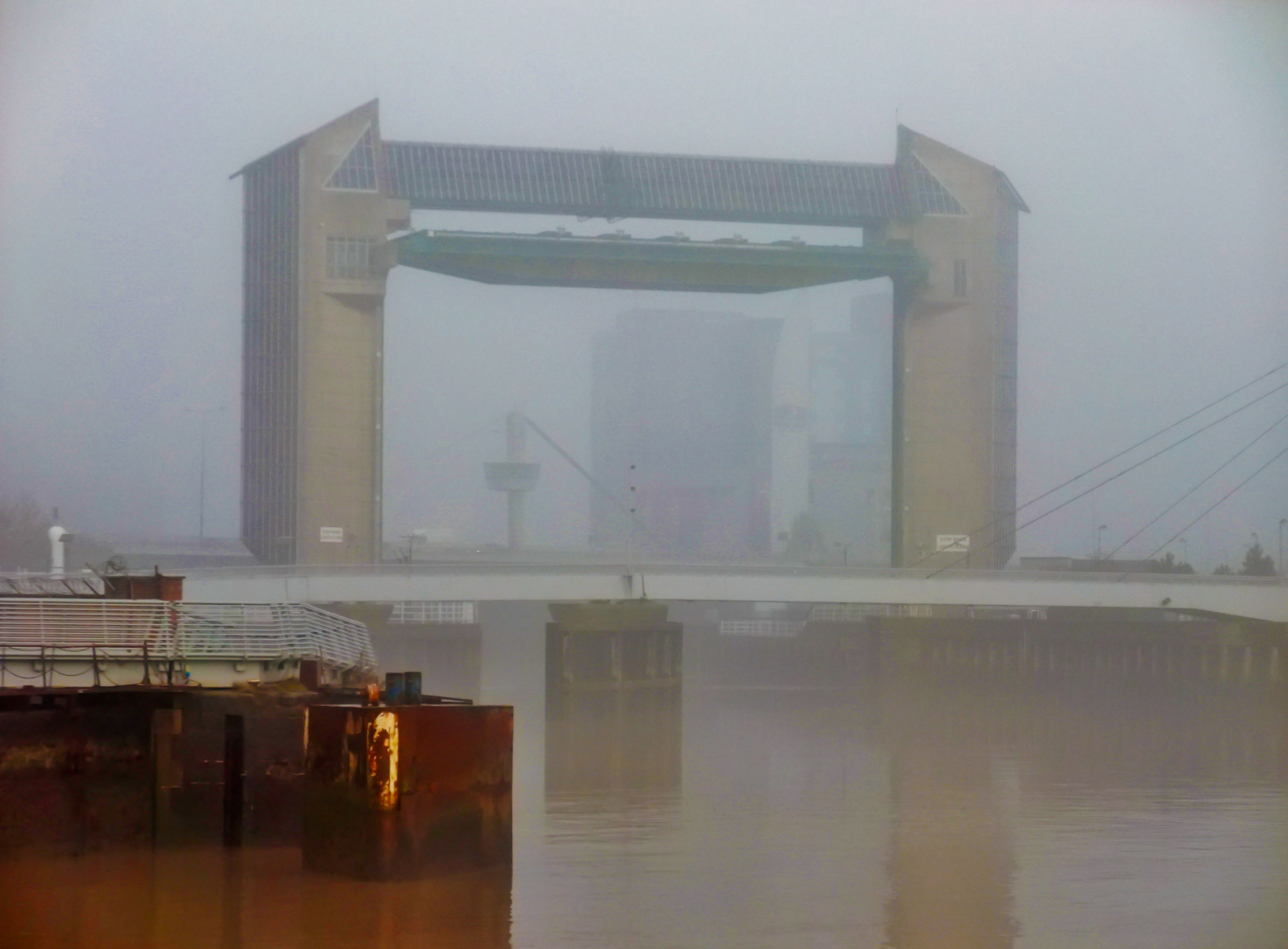
- Tidal Surge Barrier, Kingston upon Hull Wednesday, 29 December, 2010 Kingston upon Hull has a very long history of the land adjacent to the river Hull being flooded due to tidal surges. To eliminate this ongoing problem, the Hull Tidal Surge Barrier was constructed at the mouth of the river. It was opened 15 April 1980. A misty morning, and the Premier Inn is but a grey shape in the background.
- River Hull, Kingston upon Hull Thursday, 14 February, 2013. Looking towards the Humber estuary from the footbridge across the river.
- Humber Estuary 2009. A coaster passes Sammy’s Point, at the confluence of the river Hull and the estuary.
Thanks very much to Bernard for the permission to use both the images and text – all copyright Bernard Sharp and published under licence.
Rich and Lou Duffy-Howard