The Impounding of the River Hull – Lutyens & Abercrombie

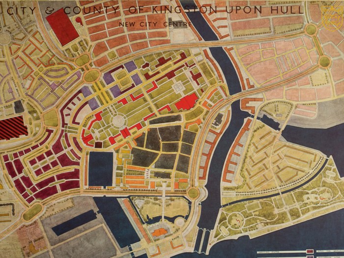
A Plan for the City and County of Kingston Upon Hull
“The River Hull is just as important as a “highway” for commerce as the roads and railways are highways serving the public, and as such the planner is concerned with its condition and use. Its use has been given its place of importance in the preceding Chapter on “Industrial Development and Zoning”. The purpose here, then, is to discuss its condition as a commercial highway and the means for preserving and improving it and turning it into a dock.
With regard to its present-day condition, it is fair to say that the River is in no better state than it was a 100 years ago when the Tidal Harbour Enquiry of 1845 was held.
Then, in the Harbour Master’s evidence, it states: ” the docks “* he had named were of considerable service to particular parties, but it would be a great improvement to the navigation to have them all removed, and that the witness had had some experience of other ports, but that he never knew one in a more neglected state than the Old Harbour at Hull.” This statement was supported by the Chairman of the Enquiry, who said: “Nor did I during the thirty-three years that I have been at sea.”
Wolfe Barry, in his Report of 1881 to the Commissioners of the Beverley and Barmston Drainage and the Corporation of the Town of Kingston upon Hull, states that the declivity of river bed is rapid and the consequent velocity of the current at low tide is so great that craft experience great difficulty in entering from the Humber, and having entered they cannot proceed up stream until the return of the tide owing to insufficient depth of water. This condition is largely due to the existence of these “docks”, which have reduced the navigable channel to a gulley of 40-50 feet wide. Any dredging of these “docks” would cause serious inundations and undermine the buildings on either side of the River.”
* The “Docks” are artificially constructed under water wharves of berths for the ships or barges to rest upon at low tide. Often carried out by means of chalk or stone deposits.

A Plan for the City and County of Kingston Upon Hull, 1945
“The use of the River by shipping is restricted to vessels of about 900 tons, which can go up the River as far as Stoneferry on the tide, as well as to lighters. No vessel of considerable size can use the wharves and are forced to go into the Humberside docks, where their cargoes are transported in lighters to the River Hull wharves either on the flow of the tide or occasionally through the Drypool basin. This limitation has its compensating advantages since there are no dock dues payable for this “overside” transport of cargoes and since the various industries dependent upon bulk supplies of raw material have created large storage warehouses; it is also not uncommon for the industries to retain the hire of the lighter or barge for storing the merchandise for convenient periods while they lie up alongside on these “docks.”
Another important consideration in studying the problem of the River Hull is the discharge from several open freshwater drains, of which the Beverley and Barmston and Foredyke streams are the most important. These are clearly shown on the various folding maps. In fact, in the opinion of the Ministry of Agriculture Drainage experts, these are the only two that need be considered as serious obstacles when considering improvements.
The Impounding Proposals
It is clear, then, that the River only provides for a limited use by all of the Industries concerned which have managed to adjust themselves to these conditions with the help and ingenuity of the bargee, who selects the right moment for tidal assistance to come up the River loaded with the merchandise.
An accumulation of river craft awaiting a favourable tide is created causing congestion in the Old Harbour.
The cheap form of transport and cheap storage in the barges, where they may lie up on these improvised chalk beds or “docks,” is acceptable providing the business is kept within the limits of this arrangement. It is difficult to imagine, however, a business finding in this arrangement an opportunity for expansion or to appreciate any attractive economic conditions in the double handling of heavy cargoes for new industries dealing in a big way. But the proposals allow for the total area of industry in Hull to be doubled and for further expansion east of Hedon Road if required. How is this to be realised? Mostly from increased imports and exports on a scale far greater than the best of the pre-war years. Then the inadequacy of the River Hull will be manifest for the increased demand for shipping space is bound to exceed the River’s capacity which nothing short of the Impounding proposal could remedy. There should be a steady acquisition of the wharfage rights by Parliamentary sanction ultimately for the greater purpose of impounding the River Hull and removing the incumbrances to this commercial highway, which is like an arterial road choked up with parked vehicles with passage limited to the small delivery vans.
There is at present no authority to control the use of the wharfages, the Freeholds of which lie in the hands of numerous individual owners. After much deliberation the various experts, including those concerned with the drainage of the hinterland, have expressed the opinion that ” if the maximum”* navigation standard† proposed is similar to the normal low water level of the River above Stoneferry Bridge, it is possible that there would be no material hindrance to the discharge of upland river water, provided the weir crest at the upstream end of the “dockised’ length is sufficiently long.
*Maximum navigation standard means the level of the water in the impounded length of the River which remains more or less constant.
Such a standard would give a depth of 15 feet 0 inches at the river mouth under existing conditions and could be extended up to Stoneferry by dredging. (This would mean an average of 8 feet 0 inches of dredging of 18 feet 0 inches to 22 feet 0 inches to obtain navigational depth for 5,000 to 10,000 ton cargo ships.) Additional pumping facilities would be required at the Barmston outfall to compensate for the gravitational discharge now obtained, and the Foredyke stream discharge would also have to be wholly pumped at the New North Bridge outfall or provision made for its diversion in the manner suggested by Barry. It was decided to propose the impounding of the River Hull and its widening and straightening in order to obtain all the advantages of an inland dock capable of handling big and heavy cargoes and thus raise the resources of the Port of Hull to the level of the biggest in the country, and bring the River Hull into line with the other major proposals such as the Humber Bridge project and of the Railway Level Crossings solution.
This improvement to the River Hull would together with the vastly improved communications which the Humber Bridge envisages, offer no mean alternatives to some of the industries decentralized from the overcrowded centres; but the conception of what is required must go well beyond the condition which merely catches up with the state which prevailed sixty to a hundred years ago. [103]
For further consideration the following notes and comments may be of value :
Standard Water Level below O.D.N.
(1) It is possible to seek a lower standard level to obtain a normal gravitational discharge for both the two principal drains and without need for pumping facilities which would ultimately improve the drainage of the city as well as the hinterland. For instance, a standard water level of -5 O.D.N. would probably be sufficient involving only an additional 5 feet O inches to the average initial dredging required for navigational purposes. Seepage would not occur and it is possible that the present water table level would be lowered to this standard level over a considerable area of the city with a tremendous saving in reconstruction costs for buildings.
Standard Water Level above O.D.N.
(2) The imposition of any navigation standard level above O.D.N. would, it is thought, inevitably involve either the pumping of the upland river water into the ” dockised” length, or its diversion by a new channel into the Humber as suggested in Wolfe Barry’s Report of 1881. Owing to the building development which has since taken place, it is doubtful if the latter’s scheme could now be considered a practical proposition. Any level above O.D.N. would create danger of seepage with consequent flooding of basements.
Dredging
(3) As a result of enquiries it is understood that any material dredging might jeopardise up to three-fourths of the frontages to the River Hull. Some new sheet piling has been carried out recently, but this would not be affected unless deep dredging was intended. The depths of these new sheet piles are 28 feet 0 inches below O.D.N. below North Bridge and 15 feet 0 inches below O.D.N. above North Bridge.
Widening and Straightening of River
(4) The dilapidated condition of practically the whole of the wharves is such that they will have to be renewed at an early date in the reconstruction period, and it is felt that they could well be constructed further back to allow the river to be widened and dredged. This is shown on the period plans for the City Centre. Opportunity can also be taken of the cleared areas along its route, while the straightening of the main bend may be achieved by cutting through an area where there is a predominance of out-dated domestic property.
The bend “by-passed” by this straightening might well be retained to increase river frontage.
[104]
The Proposals carried out in Stages
(5) The impounding and widening of the River Hull may be carried out in easy stages in accordance with a carefully prepared programme of construction. With the help of sheet piling it is possible to create the widened sections of the River to the approved depth before interfering with the present course of the River and thus enable many industries to carry on trading without undue disturbance. [105]
Conclusion
In conclusion it may be true to say that no attempt to create a dock out of the river is worthwhile except where the bold objective of widening, straightening and deepening the river is considered. Wolfe Barry, in his Report of some 60 years ago, rejected the idea of widening and straightening the river on account of the cost of compensation and of endangering the stability of the warehouses by inundation. It is true that any material dredging is almost certain to undermine the wharves and foundations of warehouses, but modern sheet piling methods can be the safeguard to counter that risk.
The opportunity for such a venture is more financially possible today than ever before, owing to the blitz and the dilapidated condition of the frontages which have already lost something, at least, of their original value; in fact, it may be possible to reduce compensation to the single consideration of the interruption of trade alone if a system of exchange of sites is worked out. The dock should not be tidal owing to the danger of silting up from the Humber water. A non-tidal River Hull would mean that the Beverley trawlers could not continue to be floated down the river unless dredging was continued as far north as Beverley itself and there does not seem to be sufficient justification for that.
Whether or not the cost of this project is worthwhile is hard to say, but an investigation of its possibilities should be made. An indication of how it can fit into the general plan for the city as a whole gives a broad picture of the effect of the project. In this respect one can appreciate the potentialities of the River Hull area which is to be zoned for industry greatly in excess of the area at present so occupied.”
From “A Plan for the City and County of Kingston Upon Hull”. LUTYENS & ABERCROMBIE – A Brown & Sons Ltd London & Hull, 1945

A New North Bridge: A Plan for the City and County of Kingston Upon Hull, 1945
Rich and Lou Duffy-Howard
If you’ve enjoyed the post, we’d be delighted if you’d subscribe to our blog. It’s free and you can do so by entering your email below: