We’ve come across a number of maps and plans whilst preparing articles for Open Bridges / A River Full of Stories and more recently ‘What Makes the Humber’.
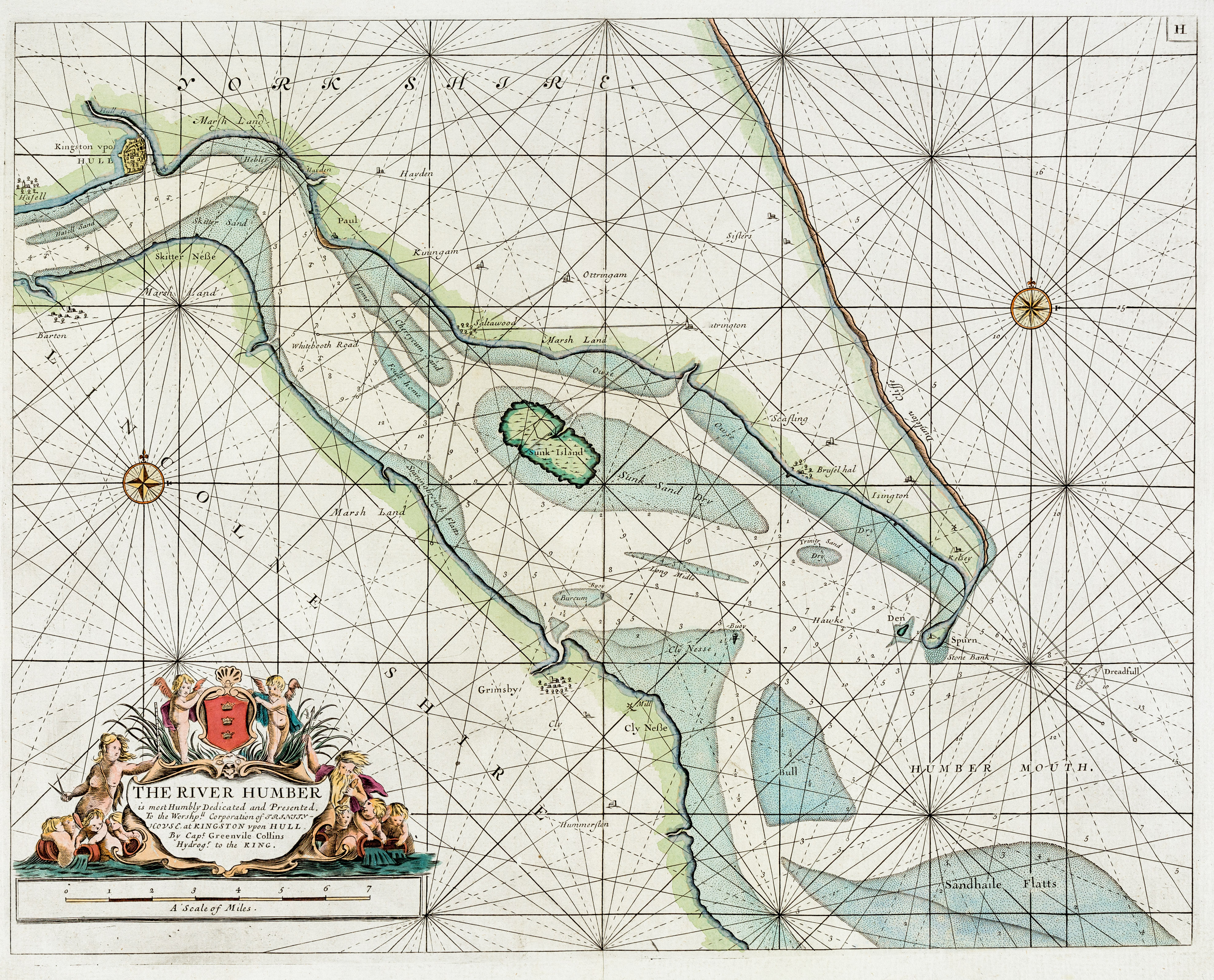
The River Humber chart below was first printed in 1693 and published until 1792, by Freeman Collins in London and is ‘dedicated and presented to the Worshipful Corporation of Trinity House at Kingston upon Hull by Captain Greenville Collins, Hydrographer to the King’. From: ‘Great Britain’s Coasting Pilot. Being a New and Exact Survey of the Sea-Coast of England by Captain Greenville Collins’.
Thanks to Rainer at GÖTZFRIED Antique Maps – www.vintage-maps.com – for permission to use their copy of the Greenville Collins River Humber map.
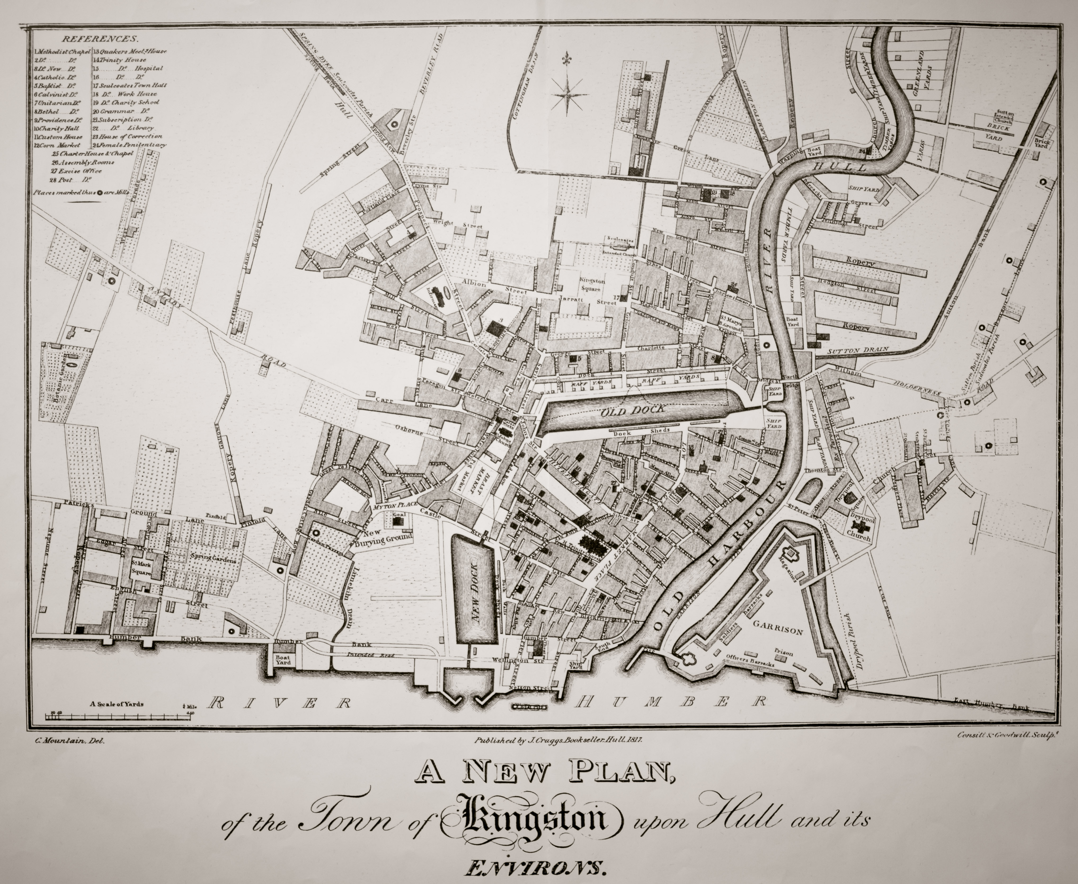
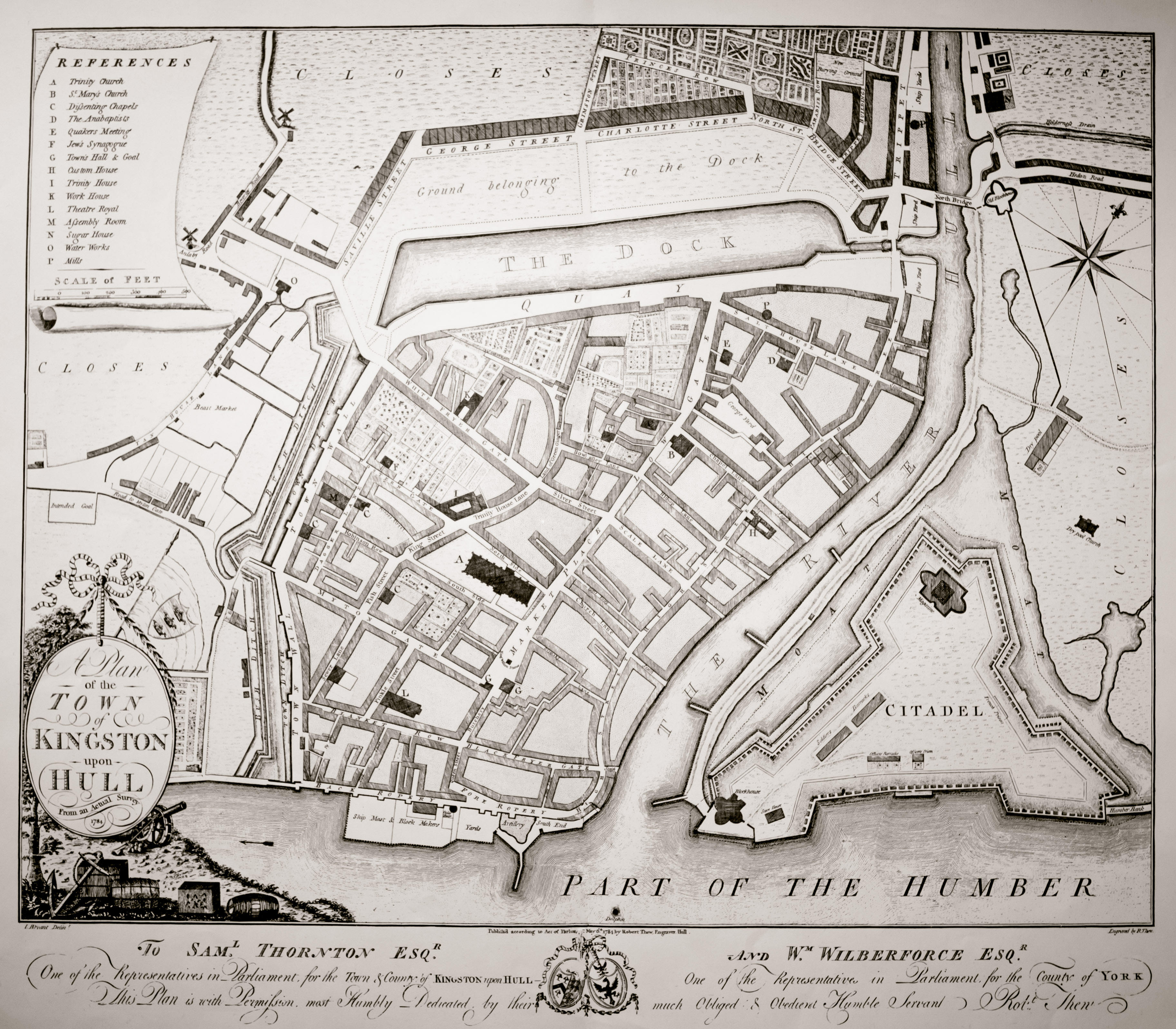
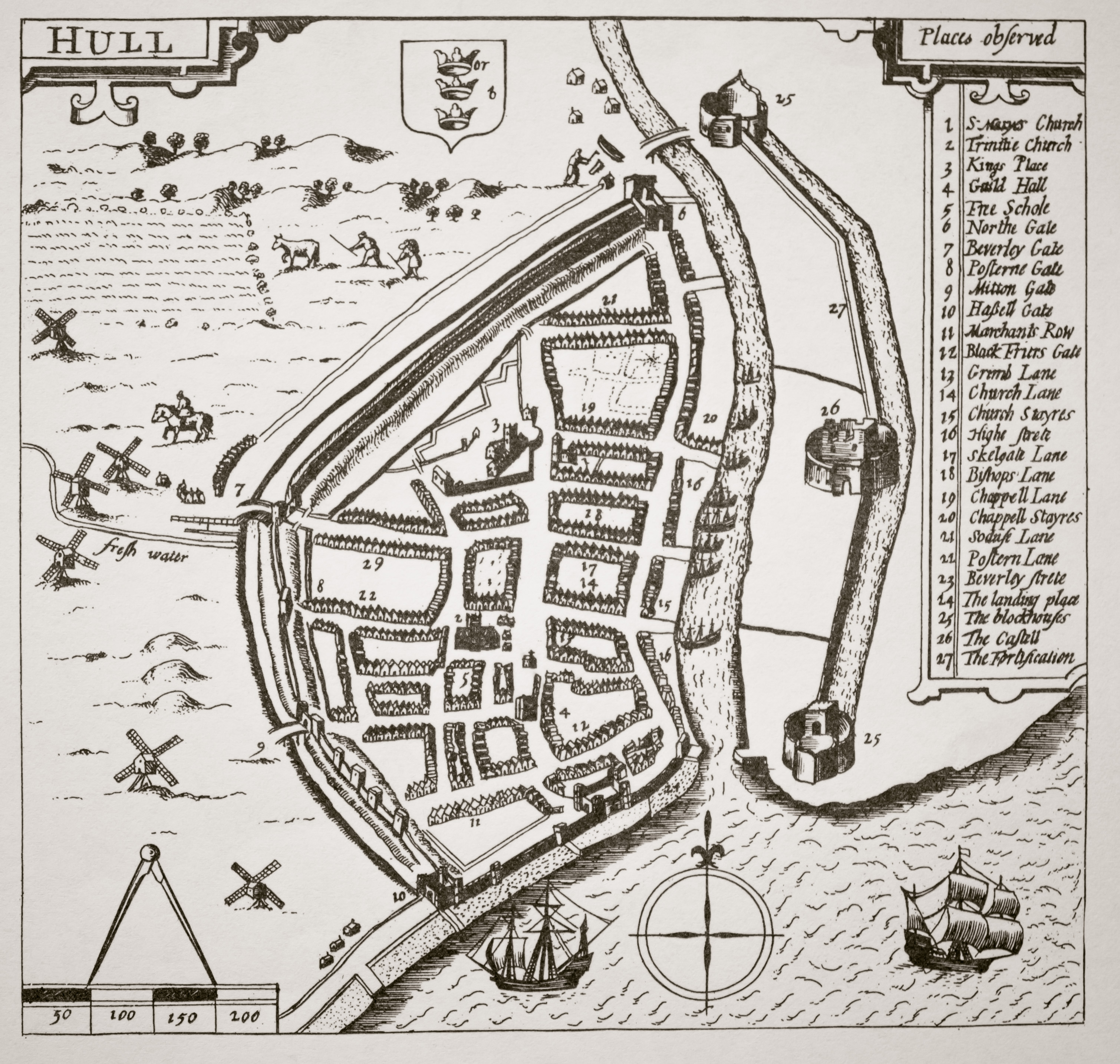
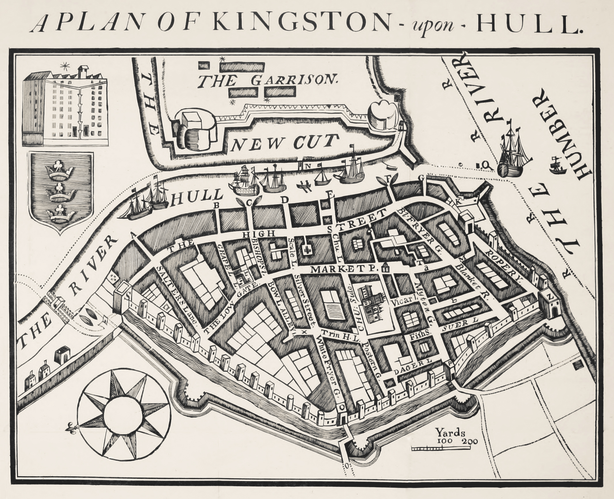
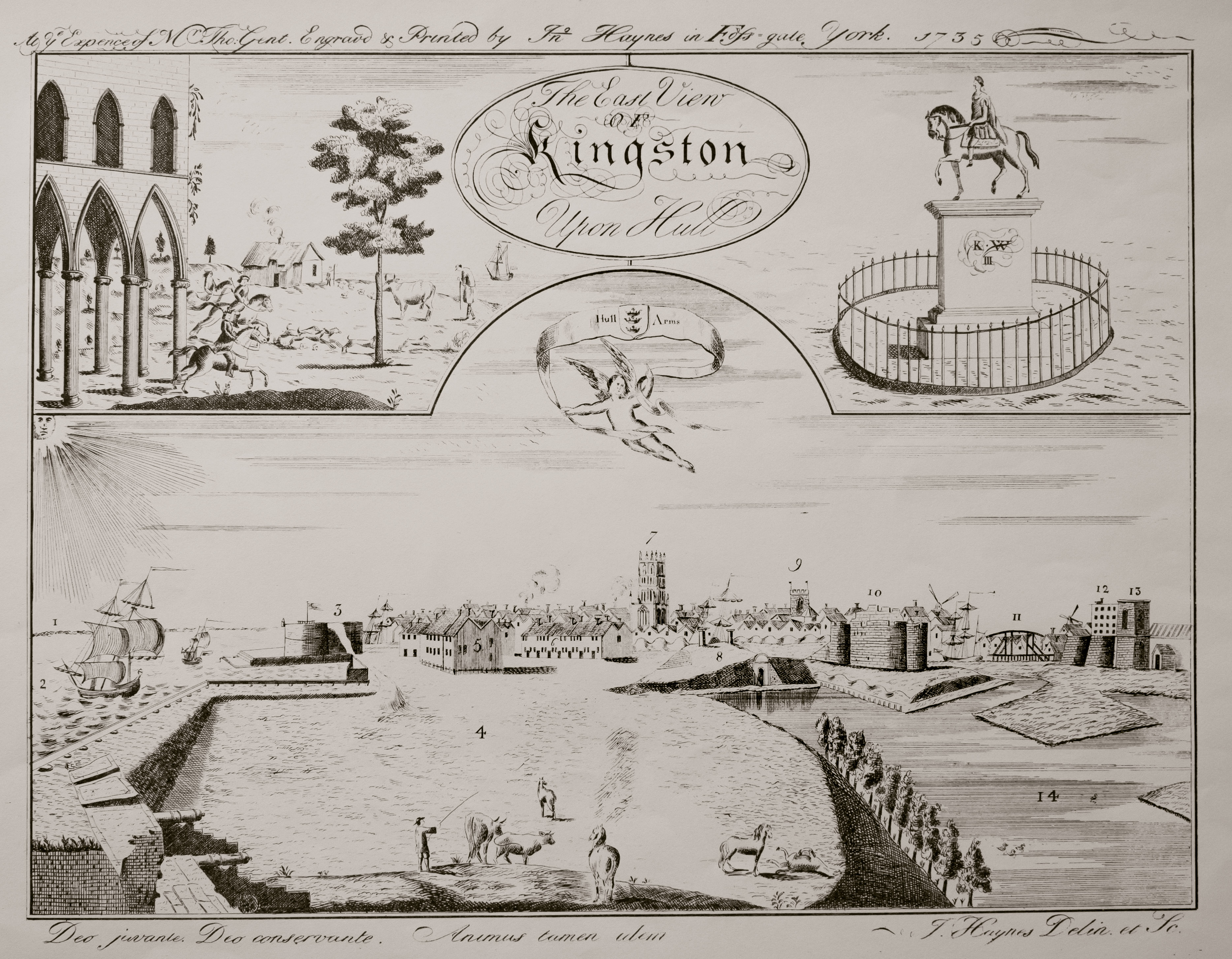
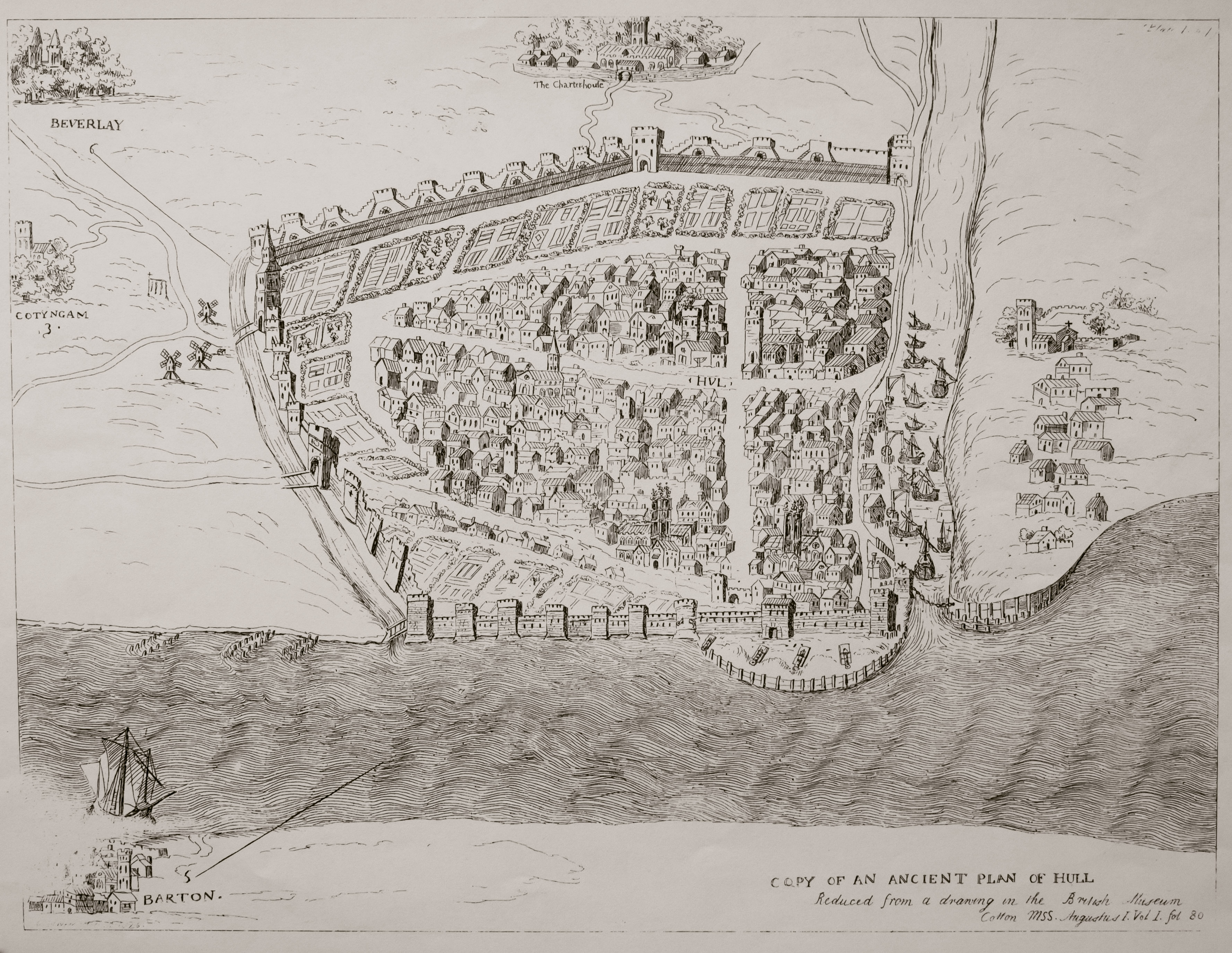
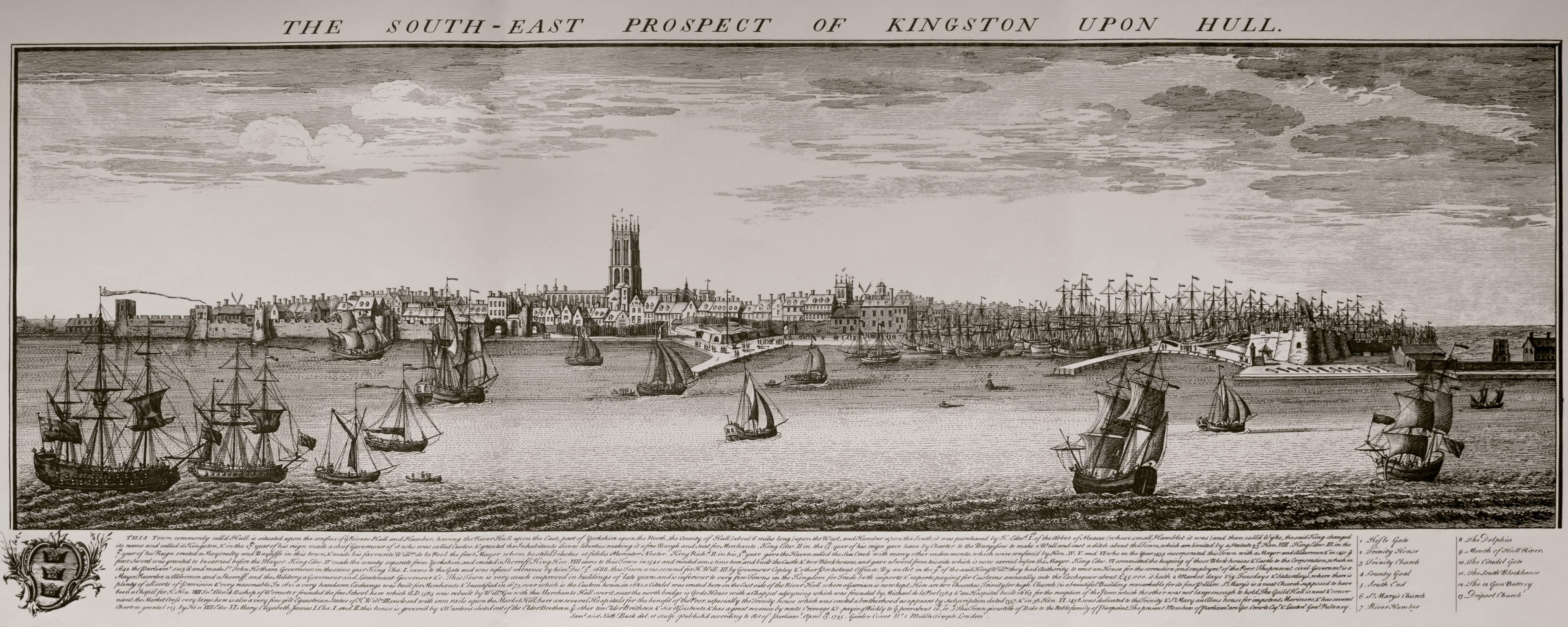
These other plans are in the public domain, but thought it helpful to present them in a single gallery here. As we come across others, we’ll add them to the post.